ViewRanger 10.11.50
| Evaluation | 4.00/5 votes - 1 |
|---|---|
| License | Free |
| Version | 10.11.50 |
| Updated | 19.08.2021 |
| OS | Android 4.x, 5.x, 6.x, 7.x, 8.x, 9.x, 10.x |
| Interface | English |
| Developer | Augmentra Ltd. |
| Categories | Maps - GPS |
| Downloads (today/total) | 1 / 1,034 |
| Size | 14.54 MB |
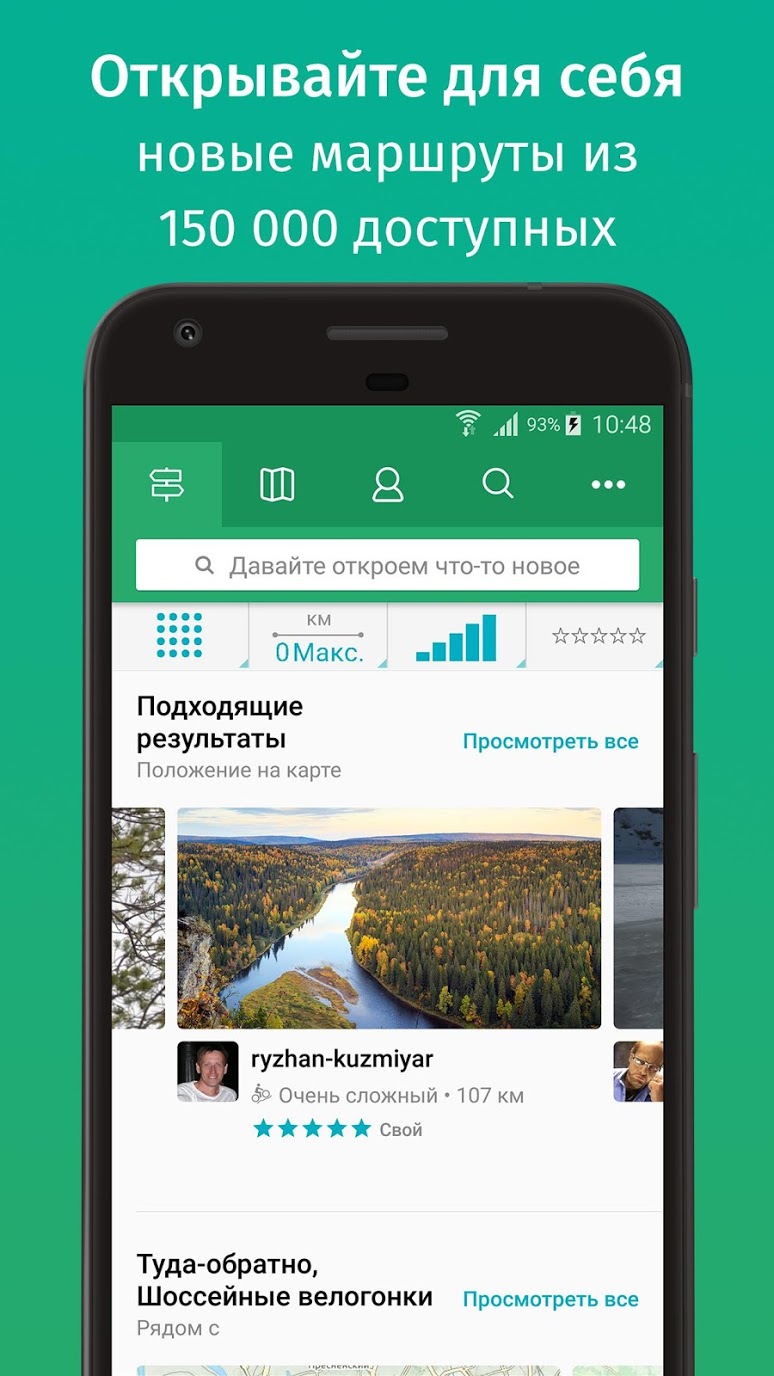
ViewRanger is a collection of route guides, with the ability to download detailed topographic maps and travel using an integrated navigation system.
Key features of the application:
- The presence of a unique technology of augmented reality Skyline with which you can literally animate the map of the area.
- Loading topographic maps.
- Global terrain maps from OpenStreetMap and OpenCycleMap.
- Ski trail maps, transport maps, Bing aerial photos.
- Additional paid topographic maps for Europe, USA, Canada and New Zealand.
- Create and track your own routes or download ready-made ones from a huge library of hiking and cycling routes created by community members.
- An accurate route navigation system using the GPS of your mobile device.
- Compass course, distance and estimated time to the next point or end of the route, coordinates in several formats, navigation to attractions, etc.
- Ability to work with maps offline.
- The ability to record routes, view them on the map in real time and share with friends.
- Ability to add photos to the route directly on the way from Flickr and Instagram.
- Viewing route statistics: distance, speed, altitude, etc.
- A unique system for tracking and sending location information in real time with PIN protection, which allows you to send information to friends and family (BuddyBeacon).
- Energy-saving mode.
- Device synchronization and much more.
Other similar programs


Preparation for the 2013 Unified State Exam in mathematics
Preparation for the 2013 Unified State Exam in mathematics
8091 | Free